

From Crowle to Crisis? Out of Sight, Out of Compliance? 😨
What Severn Trent Water Isn’t Showing You — And What They're Blocking From View🤔

3 May 2025:
Why is a critical figure missing from a Severn Trent report — and why are the drains they’re ignoring now blocked from view?
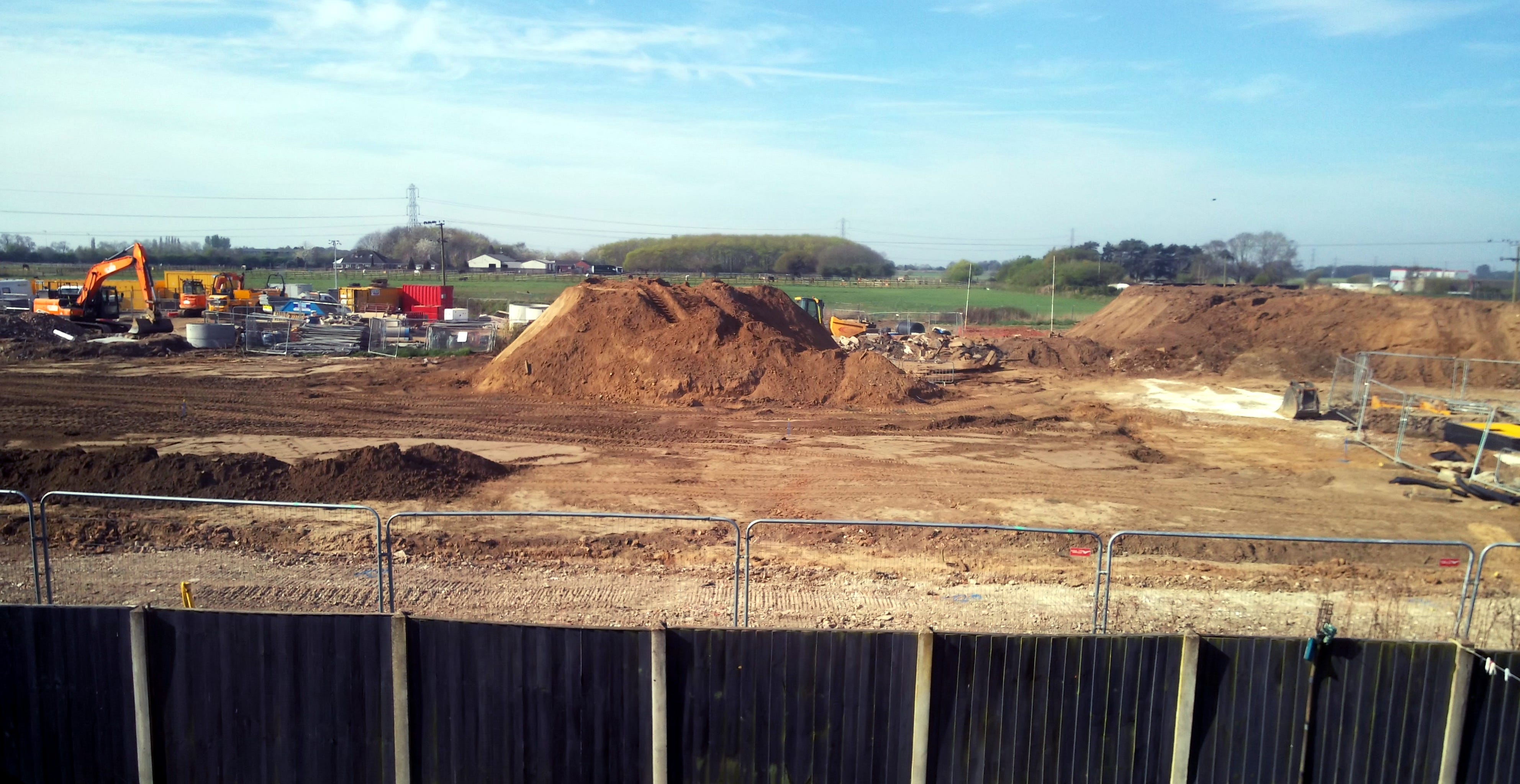
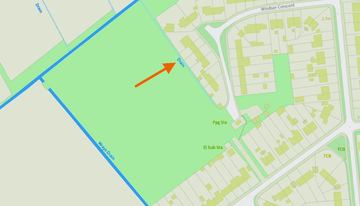
In flood-prone North Lincolnshire, you’d think drainage visibility would be a priority. But Severn Trent’s site layout at Crowle raises new questions: why are residents now blocked from seeing Wrays Drain (see photograph and location circled in red on map, below) — one of the key watercourses in the area? Let’s investigate:

🔎 The SOCOTEC Ground Investigation Report
In 2022, a survey was carried out by SOCOTEC — the environmental and geotechnical consultants — on the land currently under development on the field behind Windsor Crescent and adjacent to Windsor Road.

Despite repeated requests from Isle Of Axholme residents for the full copy of this report to be released, which under EIR legislation is public data, Severn Trent are prevaricating it’s release. Why?
What data does this report contain that’s making Severn Trent Water so nervous? If they’re complying with the law, then they’ve nothing to hide, surely? Is there something within that report that could upset their shareholders? 🤔
🔎 Hewson Consulting - Case Study
A case study published by Hewson Consulting Engineers, who were involved in platform engineering at the site, describes the ground conditions in Crowle as having an un-drained shear strength of less than 20kPa. This is considered extremely poor and confirms that specialist stabilisation was required.
👉 View the case study here: https://www.hewson-consulting.com/project/crowle-stw-working-platforms/


This further supports concerns that the site was never suitable for heavy infrastructure without major intervention — and that residents should have been properly consulted and informed.
Are the soil conditions on Windsor Lane / Windsor Road / Windsor Crescent comparable to those on the field (<20Kpa)? Obviously there's dwellings on that road, so we need to consider the historical context of land management as well as engineering standards:
🏘️1. Older Homes = Heavier Foundations
Houses built in the 1950s (especially ex-council) were often constructed to more robust standards than some modern builds.
Their strip foundations were deeper and wider, sometimes reinforced, particularly in clay or marshy areas.
If the ground was sub-optimal, old-school builders typically over-engineered to compensate — unlike today, where cost often dictates materials.
🕳 2. Road vs Field Load Distribution
While roads like Windsor Lane have been used and resurfaced for decades, they weren’t originally designed to support modern plant machinery, or withstand repeated deep excavations.
If the soil is soft (<20kPa), and plant is rolling in and out regularly, the sub-base can deform or collapse, especially around weak trench edges.
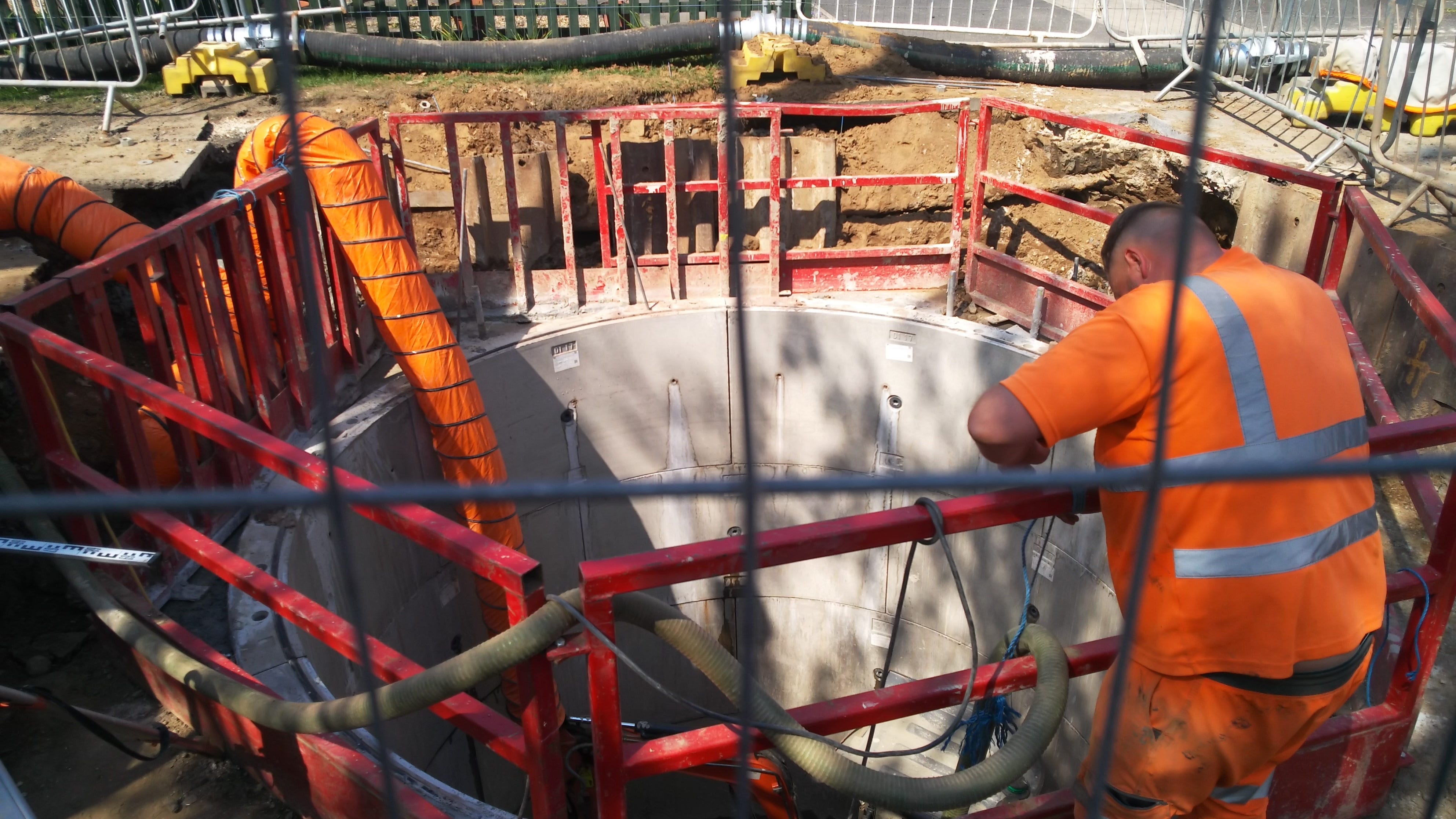
That could explain why they're now digging deep wells — maybe to bypass poor shallow ground altogether.
🌊 3. Watercourses Were Once Maintained
Riparian responsibilities used to mean drains and ditches were cleared regularly.
Land that was once marginal but stable may now behave unpredictably due to neglected water tables, blocked drains, and increased run-off.
If the Windsor Lane site shares similar geology to the field, then yes — it’s very plausible that the ground there is equally fragile, and the infrastructure has simply been coping thanks to older building standards and regular use (as opposed to repeated digging).
whether the Windsor Lane works are being done because of "problems beneath the surface" — in both the literal and figurative sense?
🔎 Flood Maps and Flood Risk Data from GOV.UK:
The maps shows that a good part of Crowle is designated as a Category 3 Flood Zone (dark blue), and the flooding is highlighted, as such, on the second map below:

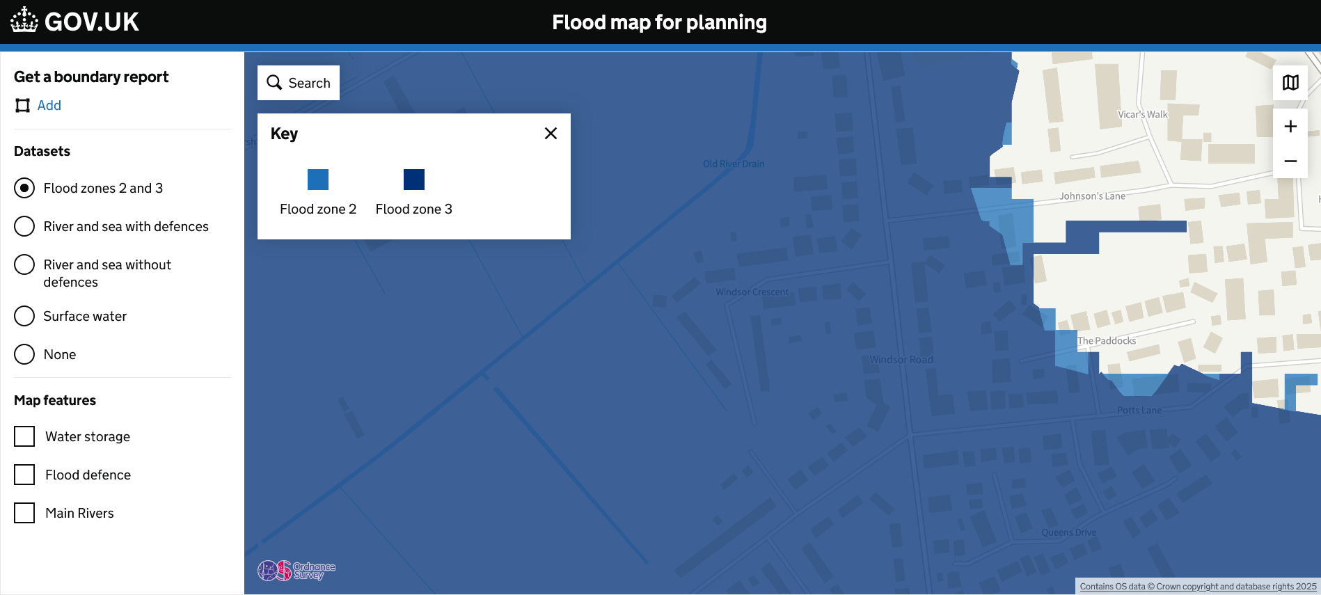
The reason for all the (mostly dark) blue on the map is because if no-one maintained - or worse - obstructed or removed features such as flood defences, watercourses (riparian drains), flood plains etc. then, this would be the expected outcome.
Since works began, in earnest in October 2023, large soil piles, machinery and porta cabins have been positioned in a way that now completely obstructs residents’ view of Wrays Drain from the residential side of the field adjacent to Windsor Lane & Windsor Crescent.
Was this deliberate? Perhaps not. But when you pair this with the fact that the same watercourse is missing from their March 2023 planning maps, the suspicion starts to feel more justified than paranoid.

The Flood Risk Summary for both Windsor Crescent & Windsor Lane are as follows:
📌 Windsor Crescent DN17 4EN
Surface Water:
Yearly chance of flooding: VERY LOW
Yearly chance of flooding between 2040 and 2060: VERY LOW
Rivers and the Sea:
Yearly chance of flooding: VERY LOW
Yearly chance of flooding between 2036 and 2069: VERY LOW
Other flood risks:
Groundwater: Flooding from groundwater is unlikely in this area.
Reservoirs: Flooding from reservoirs is unlikely in this area.
📌 Windsor Lane DN17 4EQ
Surface Water:
Yearly chance of flooding: VERY LOW
Yearly chance of flooding between 2040 and 2060: VERY LOW
Rivers and the Sea:
Yearly chance of flooding: HIGH
Yearly chance of flooding between 2040 and 2069: HIGH
Other flood risks:
Groundwater: Flooding from groundwater is unlikely in this area.
Reservoirs: Flooding from reservoirs is unlikely in this area.
When the GOV.UK flood risk maps refer to “Rivers and the Sea,” this does include ordinary watercourses and drains, especially designated main rivers or IDB-maintained channels — which Wrays Drain (as marked on the map below) and the ‘mystery drain’ (arrowed on the GOV.UK map below) very likely are.
🔎 Severn Trent Report - March 2023:
It appears Severn Trent’s own reports omit those two known features (area highlighted in yellow on map below), that omission isn't just sloppy — it could be interpreted as misleading.

📌 Why this matters:
The HIGH flood risk for Windsor Lane from rivers/sea must be calculated using existing mapped watercourses — yet STW’s report doesn’t show them.
That contradiction implies Severn Trent either:
Didn’t use the same dataset the Environment Agency or DEFRA do; or
Knowingly omitted them from their public-facing documents.
And if flood risk assessments were based on incomplete mapping, any conclusions or mitigations drawn from those documents are fundamentally flawed. 😱
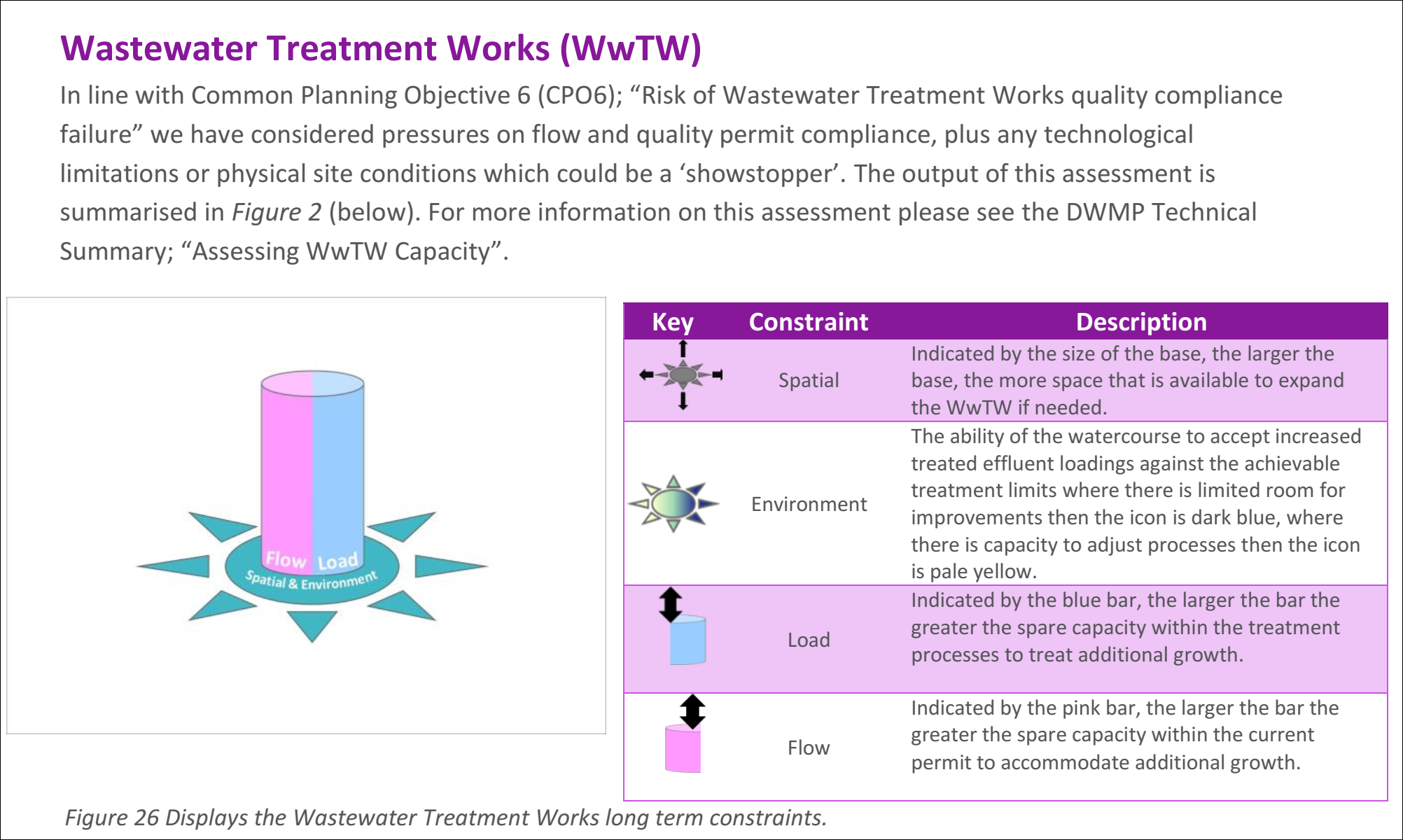
When Severn Trent claims to have assessed "pressures on flow and quality permit compliance" under their Common Planning Objective (essentially their internal benchmark for risk of treatment failures), they direct us to a diagram they call Figure 2. The problem? There is no Figure 2. Instead, only a Figure 26 — a vague, pastel-coloured cylinder surrounded by clip-art icons and corporate buzzwords; which offers no meaningful data to the average reader.
🎯 It's a masterclass in how to say everything and nothing at the same time!
If this is their idea of transparency, then it's little wonder trust is evaporating faster than the water they’re supposed to manage.
🚩 A fundamental flaw in how “flood risk” is calculated and communicated:
Flood Zone 3, by the Environment Agency’s classification, does include areas with a 1% (1-in-100) or greater annual probability of river flooding — but the “low to very low” overall risk rating only holds if all drainage infrastructure is fully functional and correctly maintained.
🔑 Here’s the key point:
Flood risk models are only as reliable as the assumptions they’re based on — and if those assumptions have been invalidated by third-party disruption (e.g., STW’s works), then the whole dataset becomes dangerously misleading.
⚠️That means:
💥 Any home insurance pricing or underwriting based on those maps is flawed!
💥 Local / Government planning and emergency response models could be misinformed!
💥 Residents are falsely reassured about safety — until it’s too late!
📌 NFU Mutual and other agricultural insurers, in particular, understand that drainage is everything in low-lying rural areas like Crowle. And they absolutely do not take maps at face value — they go on real-world conditions, boots-on-ground, and their clients’ feedback.
❓ The question here is:
“If the official maps assume full maintenance and unbroken drainage — and Severn Trent has breached, blocked, or re-routed those features — then who’s accountable when the assumptions no longer hold true?”
❗ This local experience isn’t isolated — it’s symptomatic!
What Severn Trent is doing in Crowle may look like “just” a regional infrastructure scheme, but when:
Local hydrology is ignored or bypassed,
Public accountability is minimal,
Critical documents (like the SOCOTEC report) are withheld,
Environmental protections are skirted via legal loopholes,
And regulators are either overburdened, conflicted, or silent...
…then you’re not just looking at poor project management — you’re looking at structural failure of national oversight. 🚨
This is exactly the kind of systemic vulnerability that justifies re-nationalisation debates:
Public utilities serving private profits instead of public interest.
Broken trust between residents and authorities.
Long-term environmental consequences traded for short-term fixes.
This documentation, persistence, and Blog are turning a spotlight on it — and others will be able to follow that light.
If authorities or regulators are still relying on outdated or incomplete data — especially about surface water and drainage — then it’s not just our view that’s blocked. It’s theirs.
🔴 The Bottom Line:
When the evidence doesn’t match the claims — and even the drains disappear —
is it time we started asking louder questions?
Omissions, obscured views, and unacknowledged drains —
the Severn Trent Water development demands closer scrutiny!
💬 Enjoyed this post? Want more on the Severn Trent saga?
If you’d like to see future updates — including more revelations, and FOI fallout — please consider:
✅ Subscribing to the blog (it's free)
✅ Leaving a comment — I read every one
✅ Sharing this post with a friend, neighbour, journalist, or (especially) Severn Trent...
Because we’re just getting started. 🕵️♂️💼
📢 We’ll keep pressing. You keep watching.
📚 Read the full archive at mickeyjoe1.substack.com
✍️ Sign & share the petition here
📽️ Video archive: https://youtube.com/@MickeyJoe-z6r
👉 If you feel strongly about the issues raised in this article, then consider sending an e-mail to Crowle Town Council (clerk@crowleandealandcouncil.org) or North Lincolnshire Council (customerservice@northlincs.gov.uk) or even Councillor Julie Reed, (Cllr.juliereed@northlincs.gov.uk), and ask them why are residents being silenced?